East Bay: Berkeley & Oakland
A starter set of official programs and guidance for the East Bay hills. Use this page to find chipping, inspection, and vegetation-management pathways, then request an assessment to prioritize actions by zone.
Get help fast
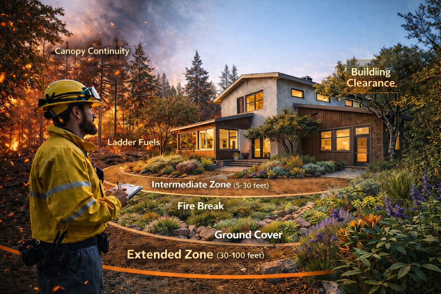
If you’re in the hills, prioritize the immediate zone (0–5 ft), ladder fuels, and canopy continuity. We can help translate general guidance into a short, property-specific action plan.
Request an East Bay assessmentCommon risk patterns
- Continuous shrubs and small trees creating ladder fuels into the canopy
- Overcrowded stands increasing canopy continuity and ember exposure
- Dry ground cover and unmanaged mulch lines near structures
- Limited access/egress and steep slopes that accelerate fire spread
Official links (starter set)
Stable, public-facing sources for residents, HOAs, and partner agencies.
- City of Berkeley — Chipper Program
- City of Oakland — Vegetation Management Unit
- Oakland — Wildfire Prevention Assessment District (WPAD)
- CAL FIRE — Defensible Space
You can also browse our Resources page for grants and funding programs used by local agencies.
City pages
Oakland
Inspection, abatement, and vegetation management pathways for the Oakland hills.
Open Oakland page →Not sure which programs apply to your property?
Most homeowners qualify for some wildfire assistance, but requirements vary by location, slope, vegetation type, and fire district.
We help residents understand what applies to their property before work begins.